Location: Drummond Range, Central Queensland
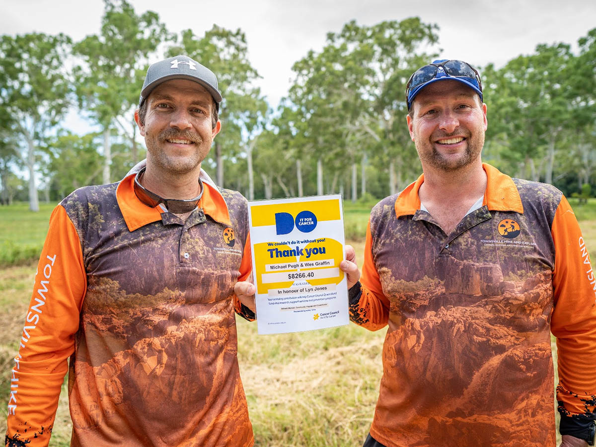
Article: Written by Michael Pugh; Imagery by Wes Graffin
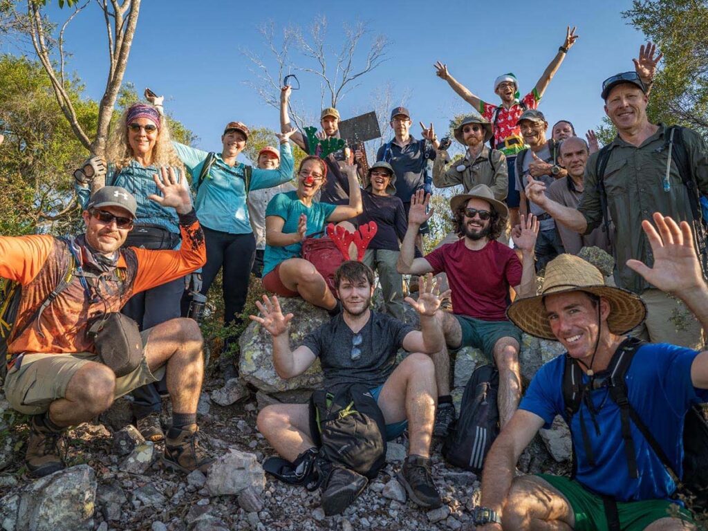
In memory of the late Councillor Lyn Jones of Clermont, and with overwhelming support from our communities across northern and central Queensland, Wes Graffin and I set off at 11.45pm on October 1, 2021 from the Peakvale Hut in an attempt to hike 70-80 kilometres in under 24 hours across some of Central Queensland’s most isolated, unique and beautiful country to raise much needed funds and bring awareness to a cause close to our hearts and a cause that has touched many of us either directly or indirectly in our lifetimes.
Our charity hike had been in the planning and organisation stage for the past two months and after a return trip of nearly 1000km from Clermont to Townsville to pick up Wes, and stopping for numerous media interviews along the way, we reached Peakvale hut at 7.30pm.
We had a superb T-Bone steak and salad on the camp cooker while preparing our hiking equipment and supplies with the aim of heading off at 12am, however as we both lay in our swags looking at the stars and thinking about the challenge that lay ahead, not much, if any sleep was had and we were up and ready to go at 11.45pm. It was also Wes’ first night sleeping in a swag!
As we hiked from the hut into the range, we gained elevation and were joined by some curious and somewhat bewildered stock that led the way for a short while.
Hiking this country in the dark under headlamp was truly something special. At one stage, we inadvertently cornered a mob of wild brumbies. I’m not sure who was surprised the most, us or them as they darted off into the range in a cloud of dust.
The previous weekend, we had driven to the ‘rain gauge’ at the 12 kilometre mark and dropped supplies, including extra water and snacks. After a quick stop and refill of our supplies, off we went again, hiking across the western extremities of the Theresa Hut Nature Refuge in the Drummond Range.
The moon appeared for a very short time just before first light, and as we stopped for a breather at dawn, we were amazed to see what appeared to be the lights of Clermont and one of the local mines, on the horizon, approximately 100 kilometres to the north. As the horizon lit up, we could also make out sections of the Peak Range, at a similar distance away on the horizon, particularly Lords Table Mountain and Wolfang Peak.
By the time the first rays of sunsine piereced the horizon over the range, we were bush bashing though some steep, grassy, rocky terrain and had left the southern extremities of the 140000 square acre Peakvale and crossed into the western boundary of Pebbly Creek. We had covered approximately 24 kilometres. Totally off trail, and with grass at waist height, this terrain was quite challenging.
One of the many highlights of the day was the sunrise over the Drummond Range. Looking around, there was range and scrub as far as the eye could see in all directions. We sat on a rock formation, got covered in meat ants and had a bush breakfast of mandarins and nuts as the sun became fully visible. This is a sight we both will never forget.


As the morning went on, the terrain remained steep and loose underfoot. Morning dew made the ground damp and the rocky terrain quiet slippery in places. We were attempting to cover as much ground as we could before the hottest time of the day. Given the height of the grass and wearing gaiters, this made the going even slower as we hiked in a south easterly direction just to the north of the Zamia State Forest.
At 7.15am and at the 28 kilometre mark, we came across one of 2 remote, inaccessible dams in the depths of the range that I had intentionally designed the trail to pass by, as we had no guaranteed water until we reached the Tomahawk Bore at the 47 kilometre mark. Although inviting, neither of us were keen for a swim yet so we pushed on.
By this stage, the sun had risen and we knew we were in for a warm day; much warmer than the forecast high of 34 degrees. At 8.30am, we were a few hundred meters north east of the second visible dam, so we decided this was a good time to stop for a decent break. Two things we were carrying plenty of was water and snacks. We had a feast of mandarins, tuna, lollies and nuts, which was a meal fit for kings on this grueling outdoor adventure.
By 9.15am, we had covered 34 kilometres and were navigating through thick, vine thicket scrub, hiking into the headwaters of Tomahawk Creek at the southernmost point of our hike. We could see communication towers to the south, approximately two kilometres away on an unnamed peak in the range.
Due to the temperature and terrain, I made some changes to the trail at this point. When hiking and exploring remote and rugged country such as this, one must pay close attention to the environment and conditions and act accordingly if conditions appear to be changing or are significantly different to what has been forecast.
I had expected the headwaters of Tomahawk creek would be special, but little did we know just how special and unique this creek line would be. The area is only accessible via helicopter and as we hiked into and through the headwaters, we were astonished to come across three dry waterfall formations which we had to hike around, including the most impressive of all, the massive granite waterfall formation of the Tomahawk Gorge.
The Tomahawk gorge was an impressive site to say the least. We hiked out onto a massive rock formation in the creekline overlooking what appeared to be close to a 100 metre drop into the creek and gorge below. This was impassible and we had to hike an adjacent creekline to the east for approximately 600 metres and follow this creek back into the gorge.
Given the conditions, the 12 kilometres from the gorge to the Tomahawk Bore was some of the toughest and most challenging hiking I can remember. Hiking this exposed creek line in the middle of the day with temperatures soaring to 39 degress challenged us both immensely. With heavy packs and tired legs, we hiked sections of the bank and used animal tracks to give us some relief from the rocky exposed creek bed, which by lunchtime was literally too hot to touch.


At 1.50pm, with 47.5 kilometres on the clock, a distant turkey nest became visible through the scrub and we hiked onto the Tomahawk Bore, a remote bore on the eastern side of Peakvale. To our surprise, the property owner was at the bore waiting for us with cold water and snacks. This was Christmas come early……
After a 20 minute break and a refreshing dip in the trough, we said our goodbyes and continued on our way.
The final 25 kilometres was a mixture of bush-bashing across the hilly country to the east of Peakvale Hut and making the most of remote property roads.
We came across a pool of water near lower Tomahawk Creek and this was again, too much of a temptation, so off came the boots and in I went to Wes’ surprise. The water was still and certainly not drinkable, but after hiking over 50 kilometres, it was a clear bush oasis!
The light began to disappear on the horizon and we marveled at the beauty of a superb Central Queensland sunset in this remote and rugged country.
At 7.23pm, we hiked into the Peakvale Hut from the east. Physically and mentally exhausted, we had achieved our goal.


Our final stats were 71.2 kilometres hiked over 19.23 hours, with an elevation gain of 1323 metres throughout the day.
The forecast maximum temperature for the day was 34 degrees. In actual fact, the temperature rose to 39 degrees in the early afternoon.
We raised a combined total of $8266.40 for the Cancer Council and Goodwill Greetings.

How to get there
The majority of this hike was undertaken on private property with permission of the relevant landowners. As such, we cannot provide directions.