Location: Peak Range National Park
Article: Written by Michael Pugh; Imagery by Michael Pugh
Directions: Access is via Huntley Road (-22.681143, 148.020076)
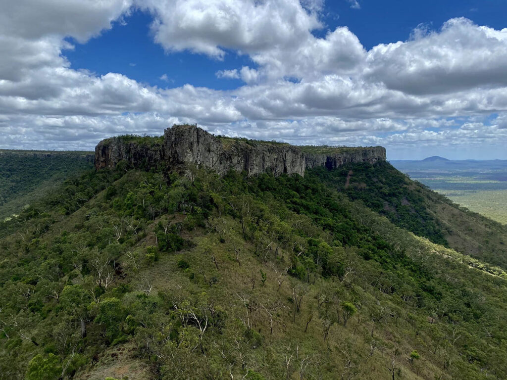
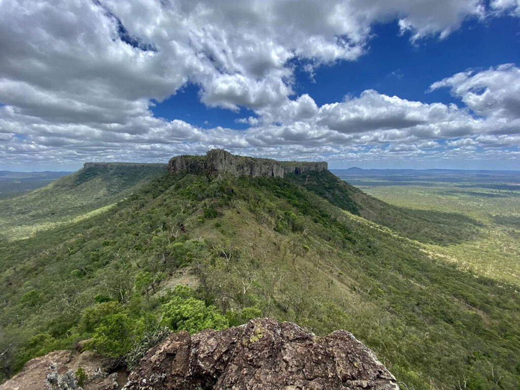
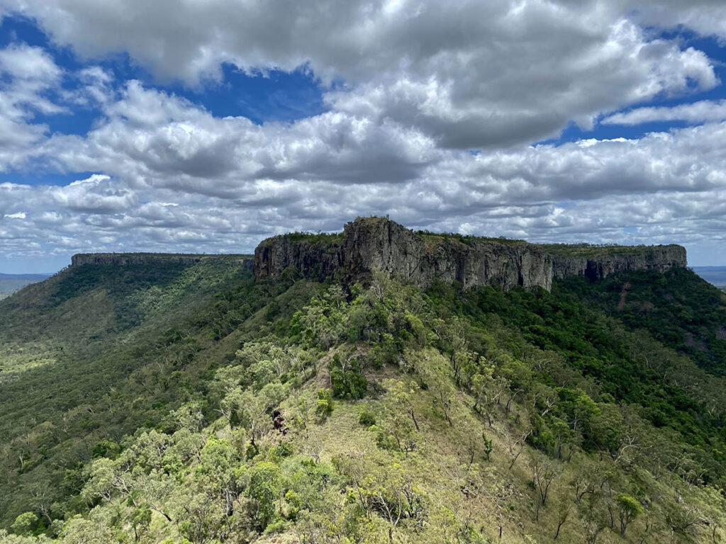
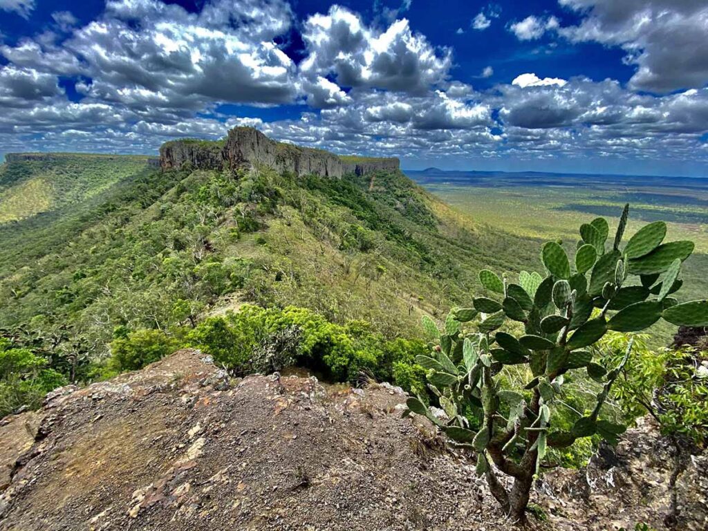
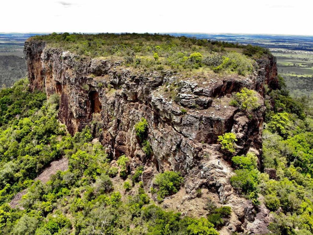
Located 35 kilometres east of Clermont or 40 kilometres west of Dysart along the Clermont-Dysart Road is Lord’s Table Mountain. Lord’s Table Mountain is also known as “Table View Mountain” or “Table Top” Centrally located amongst the Peak Range National Park, the mountain rises to 320 metres above sea level and is a flat-topped plateau. Anvil Peak is the mountain’s highest point, at the southern end.

This section of the National Park compromises 761 hectares and supports the largest area of dry rainforest in the Peak Range. It was named by Ludwig Leichhardt in 1845 and is mainly open eucalypt woodland, dry vine scrubs and mallee eucalypt at the top of the mountain.
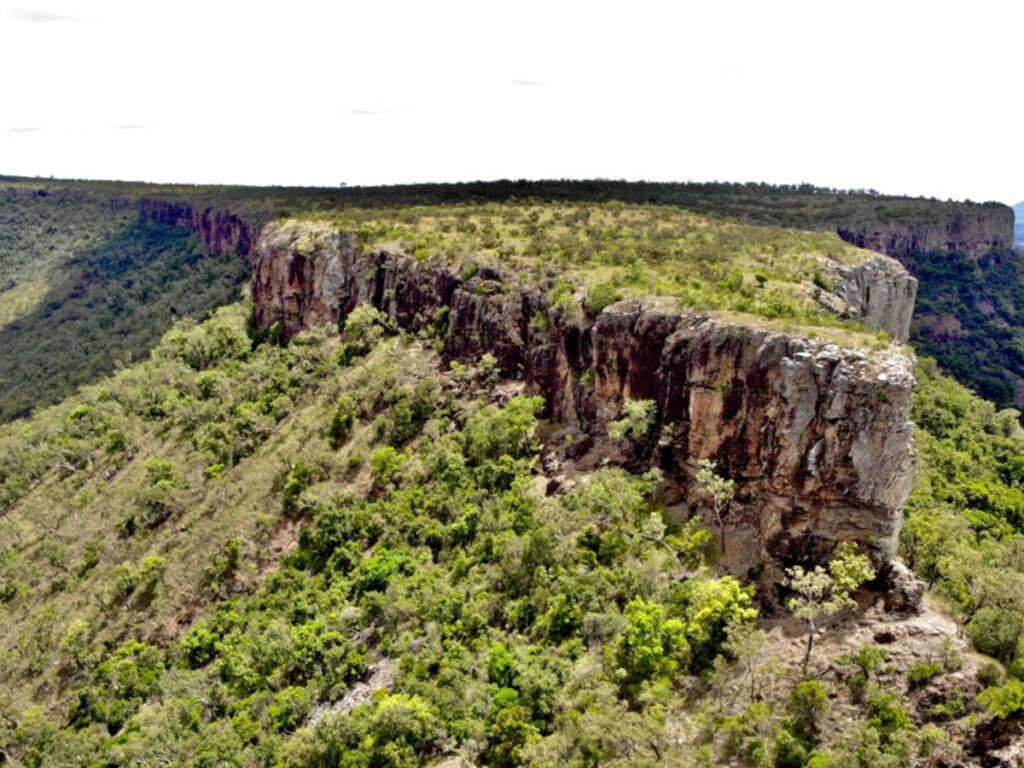
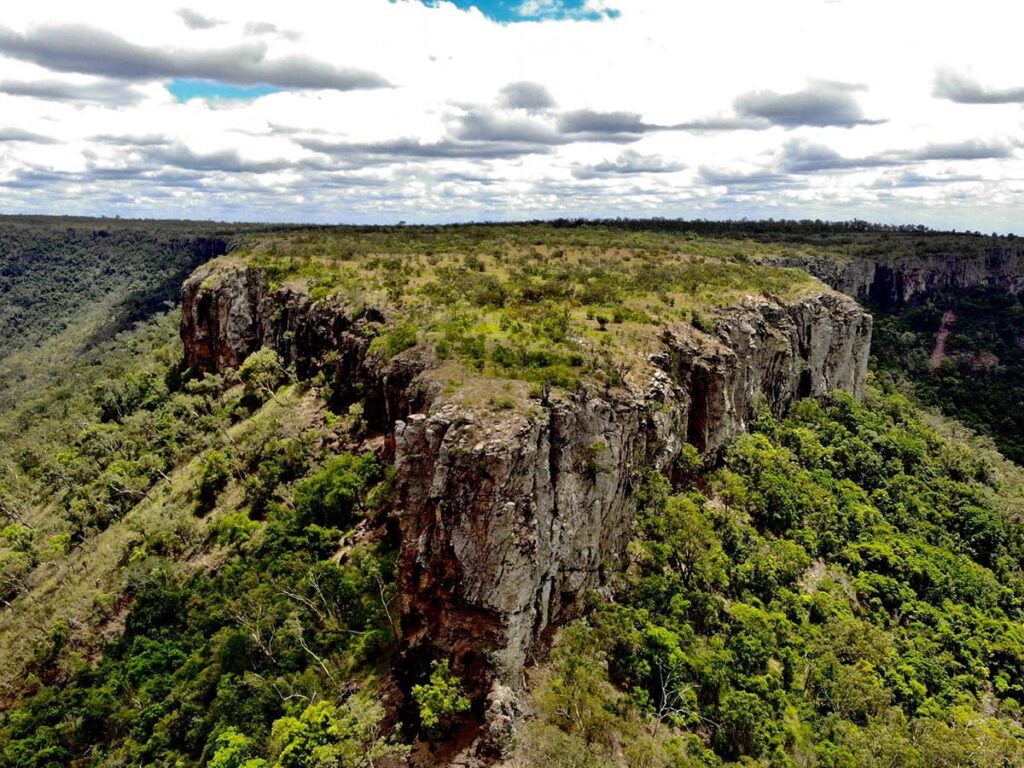
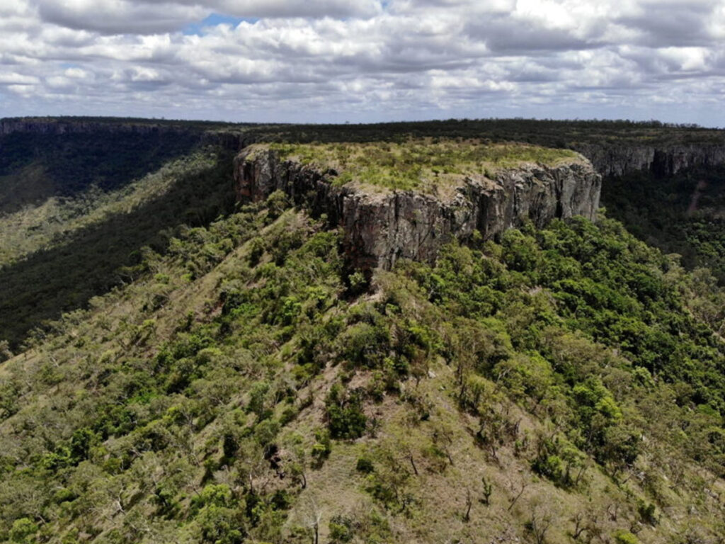
From the saddle between Table Mountain and the Anvil, the trachyandesite of the cliffs lies on a reddish-brown basalt filled with gas bubbles. The cliffs are steep and stop any further ascent for most people. Unusually there is no columnar jointing in the trachyandesite flow; instead, there is a myriad of small vertical fractures intersecting horizontal ones along incipient flow banding, resulting in the whole rock mass being shattered into small fragments less than 20cm across. Views from the saddle encompass adjacent ridges where basalt flows can be seen in horizontal layers. (www.capella.com.au)
Summiting the enormous northern plateau of Lord’s Table Mountain involves free climbing the cliffs and is recommended for those with climbing and abseiling experience. The northern plateau is an impressive 2.3 kilometres long and lightly vegetated.
Summiting the separated southern extension of Anvil Peak is possible using ropes anchored to the cliffs & trees near the saddle, however these appear old and should not be relied on. Anvil peak is 375 metres long and lightly vegetated.


Those who summit Lord’s Table Mountain will be treated to views of the surrounding grazing land, not to mention the impressive Wolfang Peak and Little Wolfang Peak to the north west. The Hodgson Range is visible to the south, however the range unfortunately partially obscures views of Browns Peak, Gilberts Dome and Eastern Peak.
Peak Access: Access to the mountain is via the Huntley Road. There is a picnic table and rest area at its scenic base. Please check the condition of the Huntley Road at your local information centre, Council Office or police station prior to your trip.