Location: Wooroonooran National Park, Far North Queensland
Article: Written by Michael Pugh; Imagery by Jo Hurford
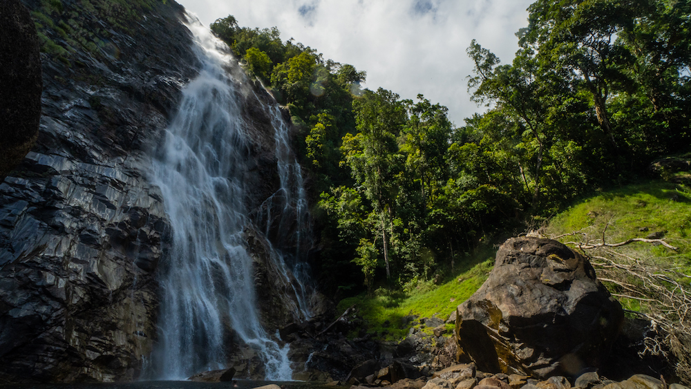
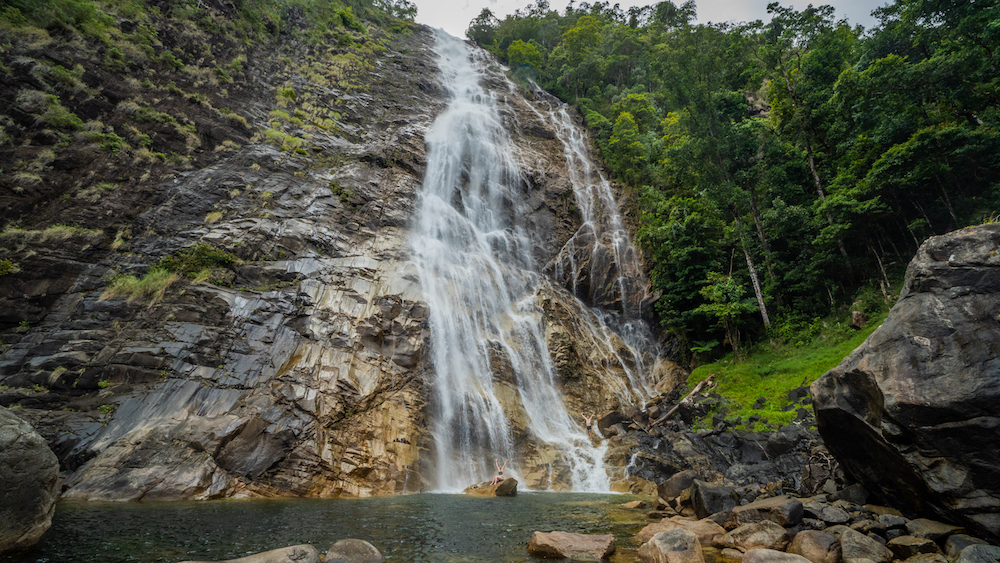
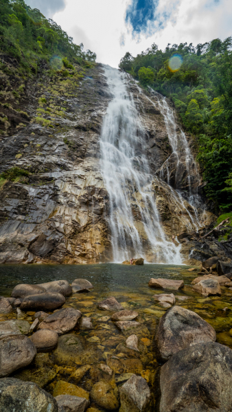
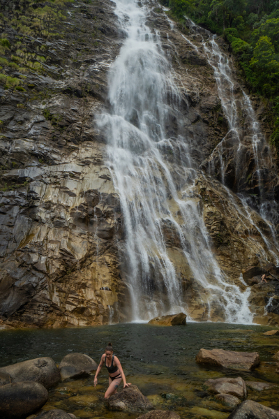
Regarded by locals as one of ‘Far North Queensland’s best kept secrets’, West Mulgrave Falls is located in the Wooroonooran National Park in far North Queensland.
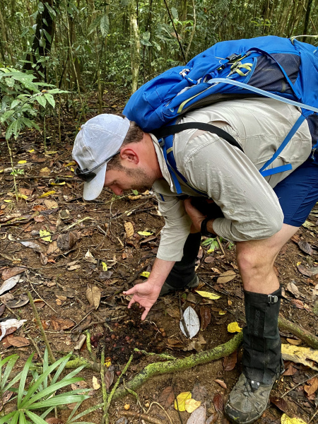
To visit the falls requires a 10 kilometre return hike through dense tropical rainforest with a steep 300 metre descent on the way in & ascent on the way back, however the effort is well worth the reward. The trail is marked by pink ribbon, however there are some sections that require re-marking.
Due to the trailhead location being within a couple of hundred metres of the Windin Falls trailhead, it’s possible for the experienced adventurer to visit both of these wonders in a day.
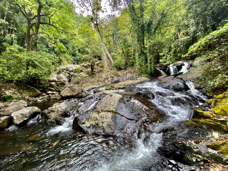
There are two creek crossings along the way to West Mulgrave Falls. If you venture further up either of these creeks a short way you will experience some beautiful and even less visited waterfall formations. Both of these creeks are known to rise rapidly so do not attempt to cross if levels aren’t safe or after heavy rainfall.
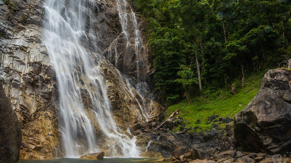
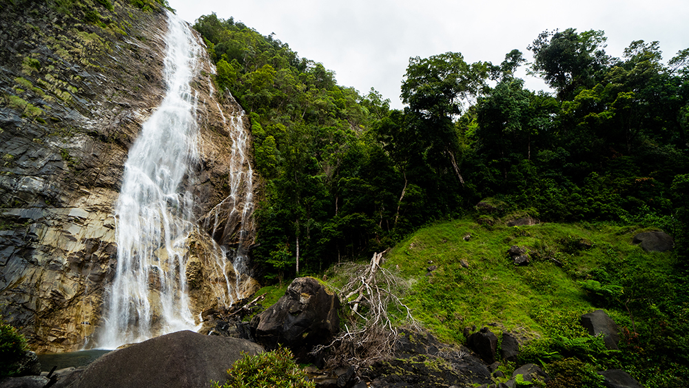
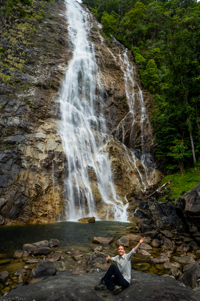
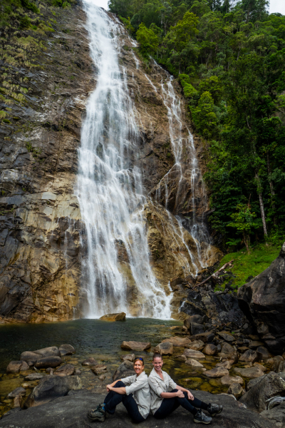
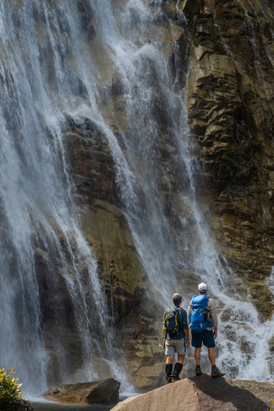
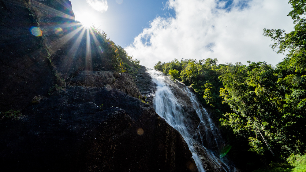
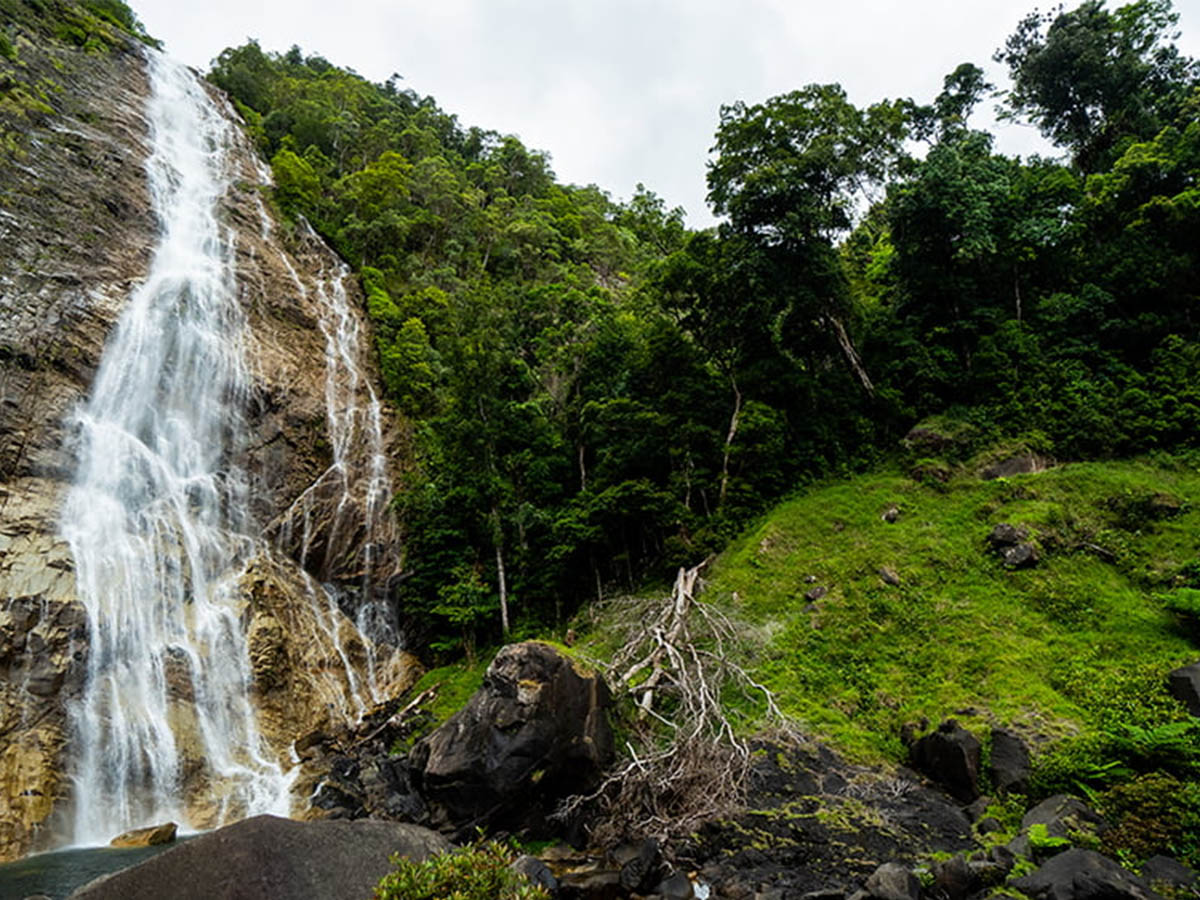
West Mulgrave Falls is a cascade falls, approximately 60 metres high, tumbling almost vertically into a beautiful aqua pool below in a picturesque gorge. Given the large boulders at the base of the falls, there’s no shortage of spots to capture that perfect ‘waterfall’ picture. If you’re lucky enough to own a drone, don’t forget it!
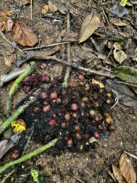
Leeches are common along the trail, so ensure you take some bushmans, RID or salt to protect yourself. Wait a while is also prevalent so include secateurs on this adventure.
How to get there
From Gordonvale, turn right and take the Gillies Range Road for 40km.
Turn left onto Lake Barrine Road and follow for 6.4km. Turn left onto Topaz Road and follow for 9.5km. Veer left at the intersection near the Lamins Hill lookout onto Old Cairns Track and then right at the intersection onto Gourka Road, as indicated by the sign to Windin Falls/Bartle Frere walking track.
After 5km along Gourka Road, the Windin Falls walking trail car park is on the left
The West Mulgrave Falls trailhead begins roughly 100 metres along the Windin Falls trail on the right hand side. The start of the trail can be overgrown and not easily recogniseable.
The GPS Coordinates for the Carpark at the Windin Falls/West Mulgrave trailhead are: 17°21’50.6″S 145°44’59.6″E
The GPS Coordinates for the West Mulgrave Falls trailhead are: 17°21’49.3″S 145°45’05.9″E
Interactive Map
Group Imagery & Video Slideshow